
Houghton-Douglass Falls
Up between Laurium and Lake Linden, Hammell Creek goes over an escarpment, making a waterfall. This would not be too notable (the creek doesn’t have a particularly high flowrate), except that the escarpment is something like 110 feet. This makes the waterfall the highest one in the state of Michigan, by a fairly solid margin. Here is the view from the top, I had to take two pictures to get most of it in because it was too tall to fit in one:
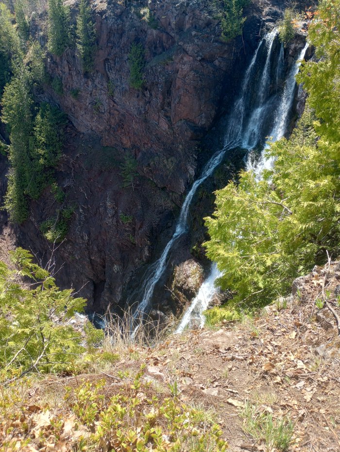
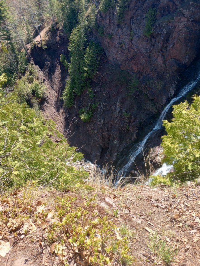
I unfortunately didn’t get a picture of the very bottom, because the vantage point was frankly terrifying – the ground was sloping about 30 degrees towards the edge, and if I slipped over the edge it would have been a long way down.
These falls were a popular spots for locals and students from Michigan Tech when I first came up here in 1980, but they were pretty controversial as a place to encourage tourists to visit because the geography is in fact pretty dangerous. People trying to scale the cliff walls had to get rescued pretty regularly, and there were a number of deaths. The falls were on private property at the time, and finally the owner decided that the liability risk was too much and closed them off to the public. And so, the falls were not (legally) accessible for some years.
Then, in 2018, the property owner sold the falls and associated 70 acres to the State of Michigan, to be turned into a state park. And as of last year (2025), they had completed Phase 1 of the project: A paved parking area, a vault toilet, and an improved trail from the parking area to a new bridge constructed over Hammell Creek. It is now sort-of open for visitors, although there is still some work to be done before it is officially fully open. The last few hundred feet of trail from the bridge to the top of the falls is still just a dirt footpath, very uneven and full of roots and large rocks. And once you get to the falls, there is of course nothing even resembling guardrails, so it is best to approach it cautiously. Once Phase 2 of the project is completed, it should be possible for people with limited mobility to get in and see the falls, but as of now, anyone who is uncertain of their balance, or who simply doesn’t care for heights, should probably wait a bit.
So anyway, I had been to the falls a number of times back in the 80s, but this was the first time I had been back since our kids were born. And it is even more nerve-wracking that I remembered it being. I’ve never been good about heights, and this was . . . not . . . helping.
One confusing point about this waterfall is the name. It is commonly referred to as Douglass Houghton Falls, and I had assumed that this meant it was named after Douglass Houghton, the first State Geologist of Michigan who had the task of surveying the Upper Peninsula after Michigan acquired it in the Toledo War[1]. A lot of things are named after him, starting with Houghton County, the City of Houghton, and the Douglass Houghton Hall dormitory at Michigan Tech. It did strike me as weird that everyone seemed to be referring to the waterfall by his full name, though. And there was a hotel/bar/restaurant in downtown Houghton called the “Douglass House”, and I thought that for some reason they had named it after him, but used his first name instead of his last name.
But then, when they opened up the Falls to the public, they officially named the park the “Houghton-Douglass Falls”, which really seemed weird. Why invert his first and last names like that? And that’s when I found out that when we were calling it the “Douglass Houghton Falls”, it wasn’t actually named after just Douglass Houghton. It was also named after his cousin, Columbus Christopher Douglass, who was also Douglass Houghton’s chief surveyor, and the two of them apparently discovered the falls together. That cleared up a lot of questions – the Douglass House is evidently named after C.C. Douglass, and D. Houghton had nothing to do with it! So now, it is probably best if we refer to the falls as the Houghton-Douglass Falls just to make sure that other people don’t get confused by it as well.
[1] I sometimes refer to our state as “The Empire of Michigan”, because unlike most other states, Michigan consists both of the original territory (the Lower Peninsula, the part that looks like a mitten), and of an overseas territory (the Upper Peninsula, which if you have sufficient imagination looks like a running rabbit). And this overseas territory was acquired as a result of the settlement in a war with another state, without any input from people who might be living in said overseas territory. You know, like an Empire does. Granted, the Toledo_War wasn’t a particularly violent war, (the only casualty was when Two Stickney, on the Ohio side, stabbed a Michigan sheriff’s deputy in the thigh with a pen-knife), but it could easily have blown up if (a) the two sides had managed to find each other while searching in the woods, and (b) the Federal government hadn’t ultimately convinced Michigan to give up their rights to the Toledo Strip in exchange for custody of the entirety of the Upper Peninsula. This is one of those things that schoolkids in Michigan and Ohio learn about, but everyone else in the country has no idea about it.
So now, Michigan has possession of the Upper Peninsula, which accounts for about a third of the state’s land area, but only about 3% of its population. And maps made by people outside of the area routinely draw the UP as being part of Wisconsin, or sometimes part of Canada, and not infrequently leave it off of maps altogether. There was even a point where the UP representative got a bill passed to ensure that the UP would be shown correctly on the State of Michigan’s own maps, because they had often been leaving it off!